Tuesday, June 30, 2020

June 30: Sloppy ride to Washington


Finally, the Missouri River

Today I strike out onto the Lewis & Clark Expedition Bike Trail.  Of course, the central feature of this trail is the Missouri River which you see for the first time in this journal behind me.  I have struck out on getting my picture of the confluence of the two rivers.  In Illinois, the viewing tower is COVID closed.  Missouri has a satire park at the confluence site, but the road to it is closed due to flooding.  My guess: this road is probably closed more often than open.

So my goal now should be easy: just ride up to the source of that river behind me. How hard can that be?

So today I knocked off about 30 miles. Mostly soggy miles. I waited out a thunderstorm before leaving Audrey’s place. Eventually the rain let up and the thunder stopped. But not for long.  Shortly after starting westbound on the Katy Trail, the rain began again. I’m starting to get used to riding in the rain; I definitely enjoy the cooler temperatures when it rains. But the Katy trail gets sloppy when it rains.  I’ve been here before in the rain - the bike gets caked with sandy gray mud, along with my body and clothes from the knees on down.

The rain continued for an hour and a half.  I tried waiting it out camped out beneath the US 40 bridge, but after 25 minutes, it wasn’t letting up, so on I went. Thunder continued throughout this time although I saw no lightning.  Normally I don’t ride in thunder, but the trees provided a thick canopy over the trail, so it didn’t seem to be dangerous. Eventually I got to Weldon Spring where I shared a conversation with a guy I had passed while he was walking.  During our conversation, the rain finally stopped.

Next stop was Defiance where I hoped to pick up a new water bottle. I got to the bike shop: COVID closed.   Only open three days a week, and not on Tuesday. Eventually,I left the trail to head into Washington.  I took a picture from the bridge there over the river. Skies were lightening to the west, so hopefully drier weather tomorrow.  Before getting to the Super8, I stopped at a car wash and spent $1.75 to spray down the bike.  Darn, I forgot to take a picture before washing the bike off.

They are calling for more storms tomorrow. I may consider  a reroute off the Katy Trail. 

PS. Today is likely southernmost point of my journey. Happy that route will turn northward. Cooler eventually.

Miles: 37.3
Elevations: High 647 at Washington car wash. Low: 447 on Katy Trail
Max speed: 23.9
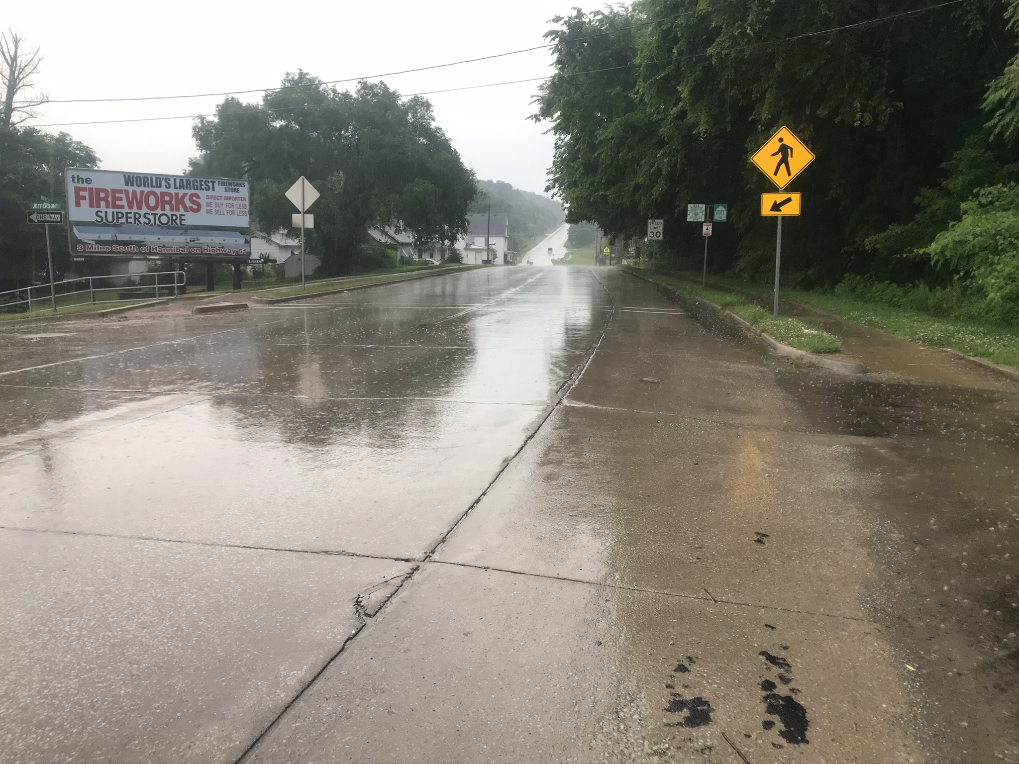
Rain on the Katy Trail today

Camped out beneath US 40
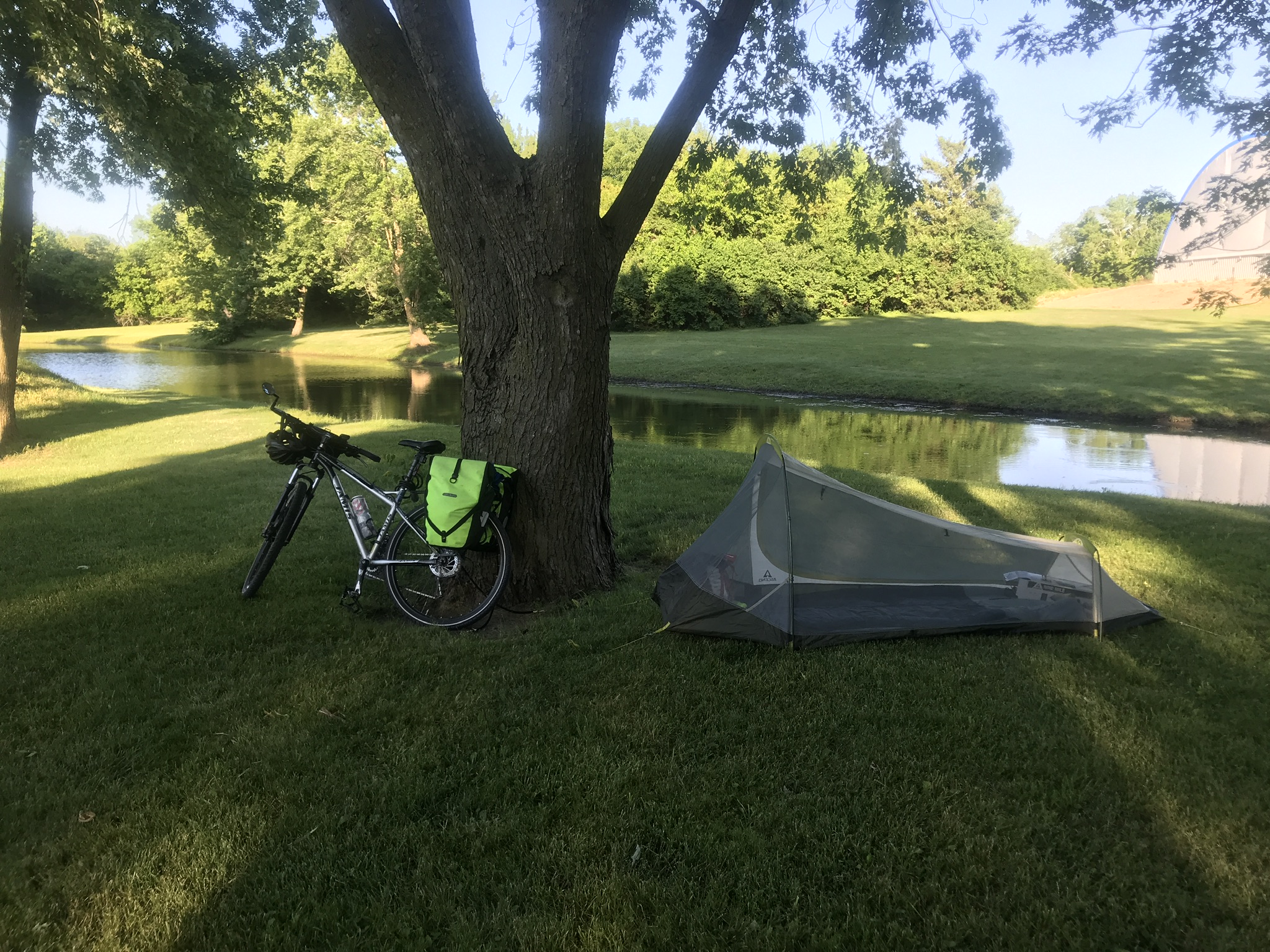
Femme Osage Creek

Femme Osage - Daniel Boone home nearby

Defiance Bike shop COVID closed

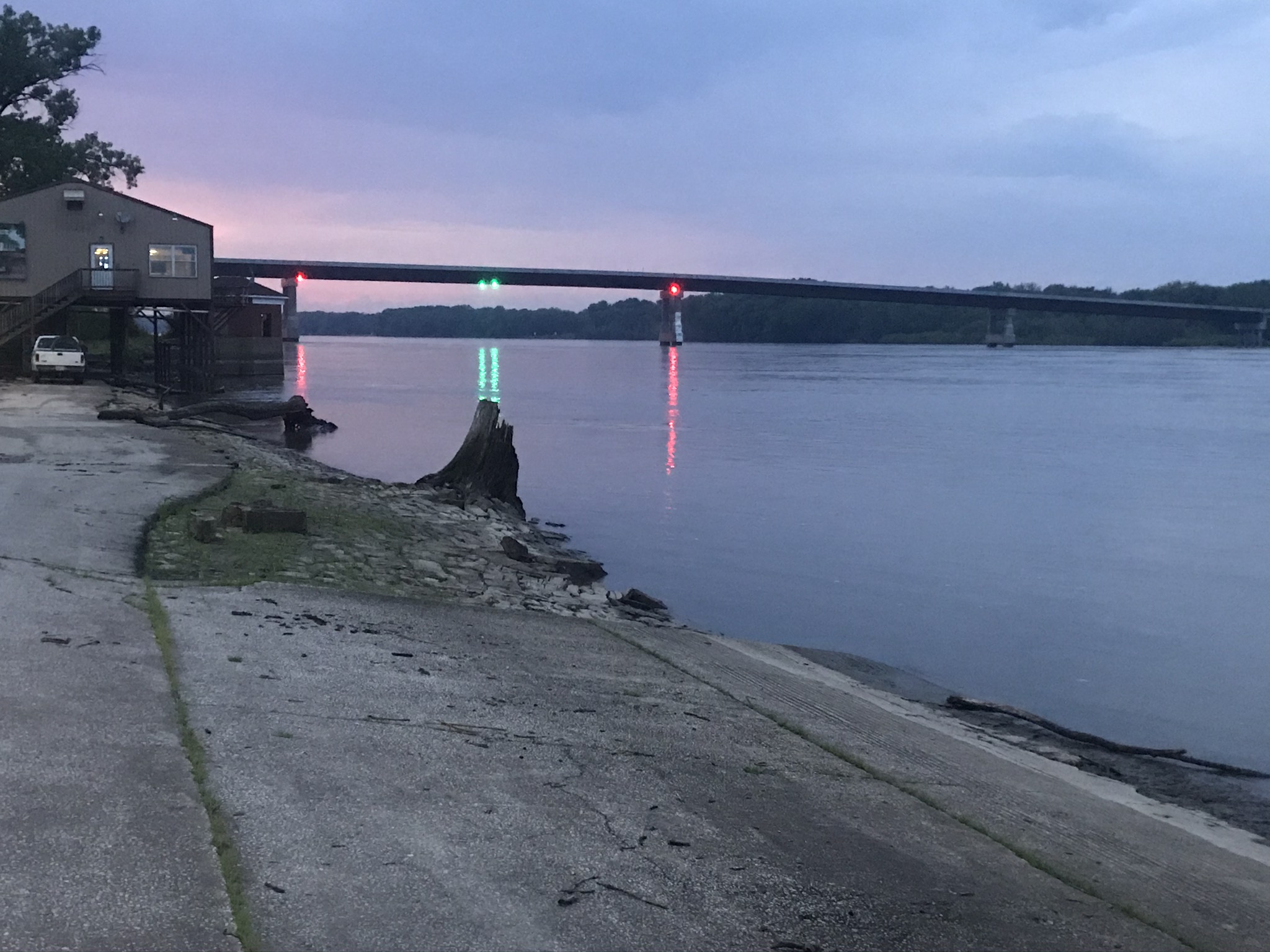
Missouri view. West at Washington
u

Monday, June 29, 2020

June 25: Start Lewis & Clark Bike Path - “We Proceed On”


Mile Zero 

Today I started the actual Lewis & Clark Expedition Bike Trail. This trail was developed by Adventure Cycling, a company devoted to bicycle travel. They have designed a bicycle route and have published a set of maps which cover the entire route.The route closely follows the Missouri River, which of course, was the route of the Lewis & Clark Expedition 1804-1806. The route is designed with bicyclists in mind, so it takes advantage of existing bike trails in the region, and also attempts to keep the cyclists on quieter roads, which are safer for biking.

So today I followed the route for the first approximately 50 miles.  The first 30 miles actually follow the Mississippi River on the Illinois side, and then took two ferries to cross the Illinois River and the Mississippi River.  The Lewis & Clark Trail then followed some quiet roads to arrive in: St. Charles, of course.  So the result of these two days of travel was to return to my sister’s place.  Kind of crazy, but I wanted to start L&C at mile zero.

Miles: 76
Elevations:  High: 676 , Golden Eagle Ferry Rd. Low: 420 Grafton, bike tire into the river
Max: 33.7
American Elm in St Charles
Milkshake at Crown Candy Kitchen

Golden Eagle Ferry Landing

Golden Eagle Ferry = Mississippi

Brussels Ferry - Illinois River

Sam Vadalabene Bike Trail

Clark Bridge - Mississippi

Nodding Thistle

Viewing Tower - Mile zero - COVID closed

June 24: St Louis area


Katy Trail Eastbound

I spent about a week at my sister Audrey’s house in St. Charles, a suburb of St. Louis. The week here was primarily for rest, and trip shakedown. I’m going to divest myself of unneeded gear, so that the uphills should be a little easier. Another important activity was writing this journal, bringing it up-to-date. Additionally, visiting the rest of the relatives, checking out some tourist areas. I also had to do a couple of bike rides while here, in order to make the bike journey one continuous line. 

Since the first phase of the ride ended in St. Charles, I had to do a ride to get to the starting point of the 
Lewis and. Lark Expedition bike trail, which starts in Hartford Illinois, at the confluence of the two rivers.   Today  I covered most of that requirement by biking to Alton Il, near Hartford. The picture above shows a rare weather condition during the summer, low humidity. Sharp horizon, clear blue skies. A very enjoyable ride with temps only in the lower 80’s.

Miles: 39
Elevations: High 630 Highway 94 bicycle overpass. Low: 426 at Alton
Max. Speed 26.0

Lock and Dam No. 26 Mississippi


Clark Bridge = Alton IL

Katy Trail Eastbound

June 21: Arrival St. Charles, MO


Mississippi River - what a difference a day makes!

Yesterday’s short ride made an arrival today an iffy proposition.  I was going to need to catch a couple breaks. Probably most important, I was going to need a flatter route. Yesterday’s hills wiped me out, with the amount of gear I am carrying. Reasonable winds and temps would help too. Audrey’s place was 65 miles away, so my largest daily mileage was needed, to complete the day.

Sunday dawned bright and sunny, and I left the hotel in high spirits, only to find out a block later, my back tire was nearly flat!  I was hoping to complete the entire trip without a flat, and I had not practiced changing a tire before leaving.  So back to the gazebo by the hotel, and I proceeded to unload the bike, remove the wheel and tire.  No problems so far, I was halfway there. I came prepared with three spare tubes, only to find out all of them were the wrong size. 26 inch tubes, but my bike wheels are 29 inches. Didn’t know that. My Sun Prairie bike shop was closed for the evening when I picked up the tubes. They would’ve known the correct size.

So I was looking probably at the loss of a day. No bike shop open in Louisiana on Sunday. I envisioned calling Audrey, instructing her the correct size, and asking her to stop at a St Charles bike shop, and let her deliver them to me.  Too early to call her yet, the only thing to do was to take the old tube, put it back on the bike, and inflate it.  Maybe it would hold air for awhile.  I could at least get a start. I rated  my chances of arrival today in St. Charles at 10%. 

So I started on the bike trying to avoid bumps and watched the back wheel. 2or 3 miles later, it was still looking fully inflated. Then I thought well maybe I can get an hour before it deflates.  If so I could probably limp to St. Charles by refilling the tire.  I’ve done that before. Well, to get to the end of this tale, the bike tire held air all the way to St. Charles!

Lots of conditions worked out for me today. The road was flat and level for most of the way. Pleasant temperatures. Just took my good-natured time, and kept turning the pedals. Along the way, I checked out the lock and dam at Clarksville. A barge was traveling upriver, so I thought I’d wait and watch the lock process. 20 minutes later nothing had happened. I stopped for a snack and came back half an hour later, barge hadn’t.moved yet. I continued and the road moved away from the river. But still relatively few hills. The area reminded me of British Columbia Frazier. River region. Some steep hills along the edge of the flood plain, but the route stayed in the floodplain. Easy Peasy. 

Using my bike GPS,  I was surprised how much of the surrounding land was barely above the river level.  This was confirmed when I saw the sign about the flood plain area. Audrey’s residence is about 150 feet above river level, so I knew there would be a few hills at the end of the day.  Not bad.

Reflecting back on this day, I was exceedingly fortunate in regard to the flat tire.  To find out about the wrong sizes for my spare tires, without losing more than an hour on the journey is amazing.  Most likely I will actually get a real flat, and if that takes place out west where it can be many more miles between places. Perhaps my wheels are an unusual size, and not all bike shops will carry that size? This could have me twiddling my thumbs for  few days. Very fortunate.

Miles: 64
Elevations: High 680, near Foley. Low 435*, near Winfield
Max Speed: 33.5

Summary: 552 miles from McFarland, which includes bike miles in the evenings after the daily ride was completed
Elevations: McFarland 856. High 1350 by Blue Mound, WI Low: 435 Winfield, MO,  End 571 St. Charles


Flat and level along the Mississippi


Lock and Dam at Clarksville

A barge entered the lock

Missouri lowlands

Something like 8 Miles to go?


June 20: 33 Miles to Louisiana - RollerCoaster Route - A Lesson


Tough Ride to Louisiana!

Saturday morning, with an early departure from my Best Western hotel in Hannibal, I encountered the first rain riding of the trip.  No disappojntment about that; rain has become preferred to temps in the upper 80’s. Due to COVID, my complimentary breakfast consisted of a grab bag, which had some fruit, and a couple small pastries, and a small bottle of water.  In addition, I had filled my water bottle with ice water. I knew that wasn’t enough water, but surely there would be a place to get more water before I left town.  Wrong: the only place was a boarded up filling station. I should’ve turned around before leaving Hannibal to get more water;  next time I will.

Rt. 79 is listed as a scenic byway on the Missouri roadmap. In this regard it does not disappoint.  Between Hannibal and Louisiana it rides up and down the bluffs along the Mississippi.  The rain stopped after about a half hour, and the sun came out and began to bake the land. The hills were many, large and steep.  Even in my lowest gear I had to dismount and walk the bike in places.  The elevation change was  over 300 feet on the largest ones. On a training ride west of Madison, a single 300 foot climb  and a couple 200 footers was considered a full workout. 

My only source of energy was a package of licorice, that I had stashed in my gear before leaving home. The route was scenic, with several pullouts for scenic views which I took advantage. Finally, very thirsty and hungry, 30 miles later I finally arrived in the river town of Louisiana. My toughest day of the ride so far, or perhaps a close second to day 2.

Miles: 33
Ave. Speed: 7.1 mph
Elevations: High 845. Low 459*
* overall trip low elevation
Max speed: didn’t record, but near 40mph

 
US 54 Bridge at Louisiana

Scenic View  from 300 feet above river

Another scenic view of Mississippi R

Crazy steep scenic route

Great River Road and Bike Route

Along Rt. 79


June 19: Hannibal, MO - First rain


First rain of the trip in Hannibal, MO

The last few days have been similar, without major sightseeing attractions, as I am making my way toward St Louis. This would change today.  I could’ve continued along US 61 all the way to the St. Louis area, and undoubtedly would have if traveling by car. So to mix things up, I decided to take a more scenic route.  This was MO 79 which closely follows the Mississippi River. Hannibal was the starting point on Rt 79.

Hannibal was the boyhood home of Samuel  Clemens, aka Mark Twain.  It is a Mississippi River town, and it’s downtown area has many tourist businesses related toTom Sawyer and Huck Finn.  I have a copy of Tom Sawyer included in my gear for light reading.

Miles: 51
Elevations: High: 674. Low: 470 ( all time low elevation on the trip so far)
Max speed: 31.6

June 18: Missouri and Oak Hollow Campground


Railroad Park at Donnellson IA

In some respects, a repeat of yesterday. Traveling south as I am taking the shortest route to St Louis. A nice early start so by late morning I was ready for a break.  I was in Donnellson, IA the last place in IA before the Missouri line. Lunch was a walking taco from of all places, a food truck.  The only other food option was Casey’s General Store, so I was happy for the variety.  Then stopped at a Dollar Store for some cookies, which I really had no good way to take along. Some kids were playing in the park and asked if they could have a cookie, so I let them finish the package. Old fashioned Dutch almond windmill cookies. Probably a new taste experience for the kids! It was fun as they asked a lot of questions about the bike and where I was going.  A geocache is hidden in the same park, and it was advertised to be a little more difficult than my typical search.  But I had plenty of time, and after a search of 30 minutes or so, I was successful.

By late afternoon, I had crossed the Des Moines River and entered Missouri. When you cross into Missouri, you are inundated by fireworks stands. I found no food on the first exit, just fireworks. Finally on the second exit, I had supper at Denny’s. The first real city in Missouri is Canton and still a ways away, so I looked for the closest campground. I stayed at Oak Hollow ⛺️.  Very new, it had a nice pool, but yet again my arrival was too late to take advantage of that amenity. The campground was around 5 miles off course; near a community named St. Patrick. Nice quiet backroads for bike travel, but the last mile and half was on a very rough dirt road.

Miles: 58
Elevations: High: 719. Low: 509, at Des Moines River
Max speed: 31.0
Geocache hidden underneath the railroad trolley car

Donnellson- Mennonite Community

Des Moines River

Missouri State Line

June 17: Pleasant ride to Updog Campground


Updog Camoground at Mt Pleasant, IA

Back on the bike after a rest day, I tried my new strategy of early starts to avoid the warmest weather of the day.  I may have mentioned earlier, that most of my training rides were done in coolish weather, usually with a jacket.  But of course the predominant  weather feature of the vacation is likely to be hot weather. Facing headwinds again today, my route was simply south along US 218, a four lane high speed highway. Most of the route featured  nice shoulder riding. At times I was able to jump off the main road to take quiet roads running parallel.

The goal today was Mt. Pleasant, which is a southern Iowa community which merits its name.  Home of Iowa Wesleyan University, it’s a quiet town. Supper was inside dining at Hyvee. Stuffed myself with some   Chinese and dessert.  Updog was the first private campground of the trip. I had a great site to myself down by the water and away from the RVs.

Miles: not recorded (estimate 53)
Elevations:  High 762. Low: 611
Max speed: 25.0 
A quiet road in Southern Iowa

Iowa backroad

Sunday, June 28, 2020

June 15 Iowa City - Hawkeye Country


Beginning of day = ready to roll from McBride St Park

After 4 long days in the saddle, I knew I needed a rest day soon. The route would turn mainly to the south now, as i was beyond the edge (west) of the Illinois-Iowa state line. After a couple days of riding to the south my route would take me southeast to St. Charles, MO, where my sister Audrey resides.

This day dawned warmer than any of the previous days, so for the first time temperatures were going to be a factor in day planning. Now traveling back into a southerly headwind I began to realize that a moderate headwind was agreeable when temps were too hot.  I was particularly a slow moving vehicle as I rode along Iowa Highway 1.  Stopping for some food and respite from the heat, Nate at North Dodge Express went way out of his way to help me find a good room for the evening. He gave me his phone and dialed the number of a local Hilton hotel. An hour later I had a room reserved!  Changing email addresses reaches into all areas ofyypur life including credit cards,  rewards programs, etc.

So far I have been impressed how helpful people have been for me. I’m wearing a  bright neon vest, and drivers are really courteous in giving me room along the edge of the traffic lanes.  Iowa City was hospitable; it’s a much smaller community than Madison. I spent two nights and gave the legs a break. I rode around the campus and got some shots of iconic Univ. of Iowa scenery.  I found a golf course a 
Nd played a quick 9 holes. Scored a 60 - easily the best score of the year for me.

Miles: 18
Elevations: High: 839. Low: 642
Max Speed: did not record
Univ. of Iowa Pedestrian Bridge

Kinnick Stadium


Old Capitol - University of Iowa

Shot a 60


I-80 Main St of America


Along Hoover Bike Path


Hoover Bike Path


Ready to Roll- Lake McBride Camping


August 11: Parshall and New Town

Van Hook Bay of Lake Sakakawea near New Town A familiar foe showed up on day 4 - a tough headwind.  Generally, this year I found the cycling...