
 |
| Survey marker 40 Degrees latitude |
 |
| Kansas cornfield |
 |
| Weaver hotel - the phone works |
 |
| My free campsite on the fairgrounds at Troy |
 |
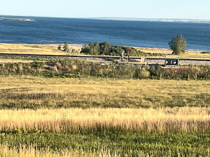
| View of four states from Scenic Hill at White Cloud |
 |
| Weaver Hotel - nice touch, don’t you think? |
 |
| Missouri River at a White Cloud, KS Sorry about the confusing order of the pictures on this page. They all belong on July 13, when I traveled to Falls City, NE from Troy, KS. The order gets confused when I enter captions on the pictures. Some pictures move to the top of the page when I add captions. Other pictures remain at the bottom. Who knows why. After leaving my free camping spot at Troy, I was barely underway more than a couple miles, traveling along US 36, a busy road, but not at that time in the morning. As I approached a side road intersection a person in a pickup truck arrived at that intersection well ahead of me, but did not proceed to make their turn. It appeared they were waiting for me. Sure enough, as I got close, the driver waved at me to come over. She said that it was a great experience that I was taking on, she thanked me and gave me a five dollar bill. She told me to use it to get something cold to drink and be safe. So while I only traveled about 50 miles in Kansas, the Kansans sure made an impression on me for their kindness and generosity. The last town I visited in Kansas was tiny White Cloud which is right on the riverbank. The picture with my bike was taken at a White Cloud. 5he small structure in the background humorously has a sign proclaiming it to be the White Cloud Marina. It looks to me to merely be a table for scaling and cutting up fish. White Cloud is home to one of the nine geographic wonders of Kansas, which is called Scenic Hill. I walked up to the top as it was too steep for the bike. It tops out about 200 feet above the level of the river. The thing that is unique is that four states can be seen from there. Kansas of course, and just a couple miles north, but on the same side of the river is Nebraska. Directly across the River is Missouri, and on the horizon across the River is Iowa. The next interesting spot was the Nebraska state line, which is exactly at 40 00.000 north latitude. The entire state of Nebraska was surveyed in relation to that marker. Ten miles later I arrived at Rulo NE, and I was famished. No stores restaurants, anything in the 30 miles since Troy. My map indicated a bar with food at Rulo. Thank goodness it was open for lunch. Many places are closed in these whereabouts on Monday. One more interesting item today. I had intended to keep track of the daily progress of the L & C expedition of 1804. They left around May 20, 1804, and had about a 37 day head start on me, since I left around June 27. It was easy to keep track while I was on the Katy Trail, where there are frequent information signs. But since I’ve left the Katy Trail, I haven’t been able to find the calendar info for L & C. Finally today, I found a sign, that indicated that L & C camped at what is now Rulo on July 13, 1804. So I’ve caught up to them. Sobering thought: it felt like it took me forever to get across Missouri due to the heat. How much harder and slower it was for L & C as they had to fight the river current. Finally my destination for the day was Falls City, county seat of Richardson County and the only place large enough to have a hotel. I stayed at the Grand Weaver, which is around 125 years old and they’ve kept it in top condition. Old style furnishings, real keys for the room doors, a four poster bed, even an old style black telephone that works perfectly for calls to the office. Miles: 40 Elevations: Max speed:      |

Hello. Just read the last couple posts. Very interesting... and the black rotary phone works!! And the lady that gave you $$ - you are on an awesome journey. Loving the L & C settlement signs. Stay safe and healthy.
ReplyDelete