
A touch of sunshine at Peru, NE
Waking up this morning I heard a flash flood warning for the last stretch of road I had traveled on the way to Falls City. It had rained hard since 3:00AM, which finally knocked down the temps. I waited until around noon for the rain to stop, and I wondered if I would be affected by the flash flooding. My goal was Nebraska City which meant a long day of riding.
This was the first cloudy day in a long time, but the cooler temps definitely were helping my performance. After taking regular roads for he first part of the day, the maps showed my route to follow the Steamboat Trace from Peru to Nebraska City. The Steamboat Trace is now a bike path which is at the altitude of the river and follows the river closely. While having some food at the first restaurant along the way some local guys told me the Steamboat Trace might be closed due to flooding. I was going to find out when I arrived at Peru.
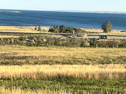
There are two sections to the Steamboat Trace, the second section I would be riding. I found a muddy track down toward the river, and when I followed it a ways, I found the first section of the Steamboat Trace along with a sign saying it was closed. I was not able to find the second section. The closest I could find was a dirt road called Bluff Road, which was heading in the right direction so I took that instead. I went past a couple of roads branching off to the right, which I knew would probably lead to the second section, but they were closed due to flooding, even though they seemed to be in fine condition. I assumed they were flooded out further along. After a few miles on Bluff Road, I finally came to an intersection, where the road to the right was open. It was obvious that road would take me to the Steamboat Trace, but it looked to be in rough shape. It was either take that road, or take the safer option and follow Bluff Road which now turned to the south (definitely don’t want to go south) and went uphill. I think most of the time when faced with this decision, I would have taken my chances with the rough looking road going where I wanted. But it was getting into the evening, and if I faced a back track, I would be riding in the dark. A younger Mark would’ve definitely taken the first option. But with the warning of flooding, I took the safe option with Bluff Road. It quickly turned back to the west, which was good, but it was steep uphill in places and stony. Several slow miles later, I came out on the main highway headed to Nebraska City.
I still had about a dozen miles to go, but I was in luck, because the road had a smooth wide paced shoulder, and I was able to make great time along that main highway. So another instance in which following the bike maps took me onto a difficult route, Steamboat Trace, with not necessarily great conditions. I am now becoming more convinced to disregard the bike maps when the route looks iffy, especially if there is a nice straight highway as an option, even though it might be a busy road. With the wide paved shoulder, I feel safe, and I make much better time.
Miles: 58 (like cloudy weather!)
Elevations: High 1155. low 900 near Steamboat Trace
Max. Speed: 29.4 mph
North distance: 41.7 miles -nice!


Bluff Road, near Peru. Heading west.

No comments:
Post a Comment