Saturday, July 18, 2020

July 16: Ride to Omaha, and Math Q2


Platte River, upstream view, near Omaha

The goal for today’s ride is to get as close to Omaha as I can. The weather forecast is predicting upper 90’s for the next two days (Friday and Saturday.) I want to tour Boystown and also possibly the Union Pacific Railroad Museum on those two days, and hope for more reasonable temps for riding to start on Sunday. So today is Thursday, and a good ride today can set me up for a nice weekend indoors on Friday and Saturday as rest days.

Today the sun is back and so I expected the weather to be warmer than yesterday.  It was, as the temp topped out at around 87.  Just a couple of views today.  By mid afternoon I made it to the hamlet of Manley, NE. About 100 people the town reminded me of Arlington, WI.  The main business was a grain elevator, and a post office and bar in addition.  

The scenic highlight of  the day was definitely crossing the Platte River near Omaha. The bike map route avoids Omaha completely. Since I wanted to see Boystown, I took a different route, and got to cross the Platte River this way.  The Platte is a  huge river. It looks wider than the Misssouri here, but I believe it is very shallow, so the Missouri carries a lot more water.

Sticking to the highways today, I had a great day and made 62 miles, and finished in Omaha. My northerly gain in miles today is an awesome 42 miles.  I am keeping track of my northerly miles now, because they are the ticket to eventually cooler weather. I reserved a Days Inn for three nights, which advertised a outdoor pool, which I planned to use!  

The Days Inn was a disappointment;I should’ve suspected since the daily rate was low. The hotel is in the Miracle Hills area, which looks like it is in some decline. An entire mall next to the hotel appears to be empty. The pool at the hotel was closed during the duration of my stay. I can also tell about the quality of the hotel internet by the difficulty in entering my journal entries. Pictures load slowly, and the mechanics of the blogger page become very touchy.  

Omaha was generally disappointing.  Of course lots of traffic, so you want to get a benefit for taking that on.  Boystown was closed. Luckily I called ahead, so I didn’t make the trip from the hotel.  The Union Pacific Railroad Museum is also closed.  Positive cases of the virus are surging across the nation, so places are not likely to be opening either. The highlight of the Omaha stay was the Wheatfields Eatery and Bakery. I found that place while in Omaha several years ago for a curling event.  It was only a couple of miles from the hotel.  The food is excellent and the bakery selection is amazing.  I ate their twice and brought home a dessert.

Answer to Math Question No. 1   (July 5). Mark averages 8 mph on flat roads. But he comes to a one mile uphill followed by a one mile downhill. He slows down to 4 mph on the uphill. How fast does he have to travel downhill to keep his average of 8 mph. The answer is it’s not possible, or you could say infinity mph. It takes Mark 15 minutes to go 2 miles on the level ground. However, it also takes him 15 minutes to get to the top of the one mile hill, which leaves him no time  left to get to the bottom of the hill.  This is a partial explanation of why flat and level trails are usually the fastest.

Math  Question 2:  This one might be easier.  You may have noticed I am keeping track of my northerly miles each day now. I am using the latitude and longitude of my ending places each day to calculate how many of the miles were in the north direction. In order to do this calculation I need to know how many miles are contained in one degree of latitude.  Another way to ask the question is if I start at 40 degrees north latitude, and travel to 41 degrees north latitude, how much further north is that?  I use the assumption that the circumference of the earth is 25,000 miles. 

                                                Manley, NB; reminds me of Arlington, WI

Platte River, downstream view

July 15: Flash Flood! Falls City to Nebraska City

A touch of sunshine at Peru, NE

Waking up this morning I heard a flash flood warning for the last stretch of road I had traveled on the way to Falls City.  It had rained hard since 3:00AM, which finally knocked down the temps. I waited until around noon for the rain to stop, and I wondered if I would be affected by the flash flooding. My goal was Nebraska City which meant a long day of riding.

This was  the first cloudy day in a long time, but the cooler temps definitely were helping my performance.  After taking regular roads for he first part of the day, the maps showed my route to follow the Steamboat Trace from Peru to Nebraska City. The Steamboat Trace is now a bike path which is at the altitude of the river and follows the river closely.  While having some food at the first restaurant along the way some local guys told me the Steamboat Trace might be closed due to flooding. I was going to find out when I arrived at Peru.

There are two sections to the Steamboat Trace, the second section I would be riding.  I found a muddy track down toward the river, and when I followed it a ways, I found the first section of the Steamboat Trace along with a sign saying it was closed. I was not able to find the second section.  The closest I could find was a dirt road called Bluff Road, which was heading in the right direction so I took that instead.  I went past a couple of roads branching off to the right, which I knew would probably lead to the second section, but they were closed due to flooding, even though they seemed to be in fine condition.  I assumed they were flooded out further along.  After a few miles on Bluff Road, I finally came to an intersection, where the road to the right was open.  It was obvious that road would take me to the Steamboat Trace, but it looked to be in rough shape.  It was either take that road, or take the safer option and follow Bluff Road which now turned to the south (definitely don’t want to go south) and went uphill.  I think most of the time when faced with this decision, I would have taken my chances with the rough looking road going where I wanted.  But it was getting into the evening, and if I faced a back track, I would be riding in the dark.  A younger  Mark would’ve definitely taken the first option. But with the warning of flooding, I took the safe option with Bluff Road. It quickly turned back to the west, which was good, but it was steep uphill in places and stony. Several slow miles later, I came out on the main highway headed to Nebraska City.

I still had about a dozen miles to go, but I was in luck, because the road had a smooth wide paced shoulder, and I was able to make great time along that main highway.  So another instance in which following the bike maps took me onto a difficult route, Steamboat Trace, with not necessarily great conditions.  I am now becoming more convinced to disregard the bike maps when the route looks iffy, especially if there is a nice straight highway as an option, even though it might be a busy road. With the wide paved shoulder, I feel safe, and I make much better time.

Miles:  58 (like cloudy weather!)
Elevations: High 1155. low 900 near Steamboat Trace
Max. Speed: 29.4 mph
North distance: 41.7 miles -nice!
                                                       Cloudy day means cooler temps

                                                 Bluff Road, near Peru. Heading west.

Tuesday, July 14, 2020

July 13: Friendly Kansas


Survey marker 40 Degrees latitude
Kansas cornfield
Weaver hotel - the phone works

My free campsite on the fairgrounds at Troy
View of four states from Scenic Hill at White Cloud
Weaver Hotel - nice touch, don’t you think?
Missouri River at a White Cloud, KS

Sorry about the confusing order of the pictures on this page. They all belong on July 13, when I traveled to    Falls City, NE from Troy, KS. The order gets confused when I enter captions on the pictures. Some pictures move to the top of the page when I add captions. Other pictures remain at the bottom. Who knows why.

After leaving my free camping spot at Troy, I was barely underway more than a couple miles, traveling along  US 36, a busy road, but not at that time in the morning. As I approached a side road intersection a person in a pickup truck arrived at that intersection well ahead of me, but did not proceed to make their turn. It appeared they were waiting for me. Sure enough, as I got close, the driver waved at me to come over. She said that it was a great experience that I was taking on, she thanked me and gave me a five dollar bill. She told me to use it to get something cold to drink and be safe.  So while I only traveled about 50 miles in Kansas, the Kansans sure made an impression on me for their kindness and generosity.

The last town I visited in Kansas was tiny White Cloud which is right on the riverbank. The picture with my bike was taken at a White Cloud. 5he small structure in the background humorously has a sign proclaiming it to be the White Cloud Marina. It looks to me to merely be a table for scaling and cutting up fish. White Cloud is home to one of the nine geographic wonders of Kansas, which is called Scenic Hill. I walked up to the top as it was too steep for the bike. It tops out about 200 feet above the level of the river. The thing that is unique is that four states can be seen from there. Kansas of course, and just a couple miles north, but on the same side of the river is Nebraska. Directly across the River is Missouri, and on the horizon across the River is Iowa.

The next interesting spot was the Nebraska state line, which is exactly at 40 00.000 north latitude. The entire state of Nebraska was surveyed in relation to that marker. Ten miles later I arrived at Rulo NE, and I was famished. No stores restaurants, anything in the 30 miles since Troy.  My map indicated a bar with food at Rulo. Thank goodness it was open for lunch. Many places are closed in these whereabouts on Monday.

One more interesting item today. I had intended to keep track of the daily progress of the L & C expedition of 1804. They left around May 20, 1804, and had about a 37 day head start on me, since I left around June 27.  It was easy to keep track while I was on the Katy Trail, where there are frequent information signs. But since I’ve left the Katy Trail, I haven’t been able to find the calendar info for  L & C. Finally today, I found a sign, that indicated that L & C camped at what is now Rulo on July 13, 1804. So I’ve  caught up to them.  Sobering thought: it felt like it took me forever to get across Missouri due  to the heat. How much harder and slower it was for L & C as they had to fight the river current.

Finally my destination for the day was Falls City, county seat of Richardson County and the only place large enough to have a hotel. I stayed at the Grand Weaver, which is around 125 years old and they’ve kept it in top condition. Old style furnishings, real keys for the room doors, a four poster bed, even an old style black telephone that works perfectly for  calls to the office. 

Miles: 40
Elevations:
Max speed:


In Kansas they say good-bye as you leave 


Another view from Scenic Hill

Lewis & Clark campsite July 13, 1804. - coincidence!
Glacial Hills Byway
Weaver Hotel - Falls City, NE


July 12: Finally I escape from Missouri!


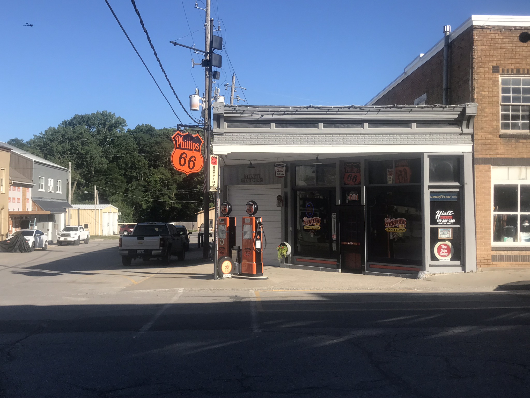
Old fashioned gas pumps in Weston MO
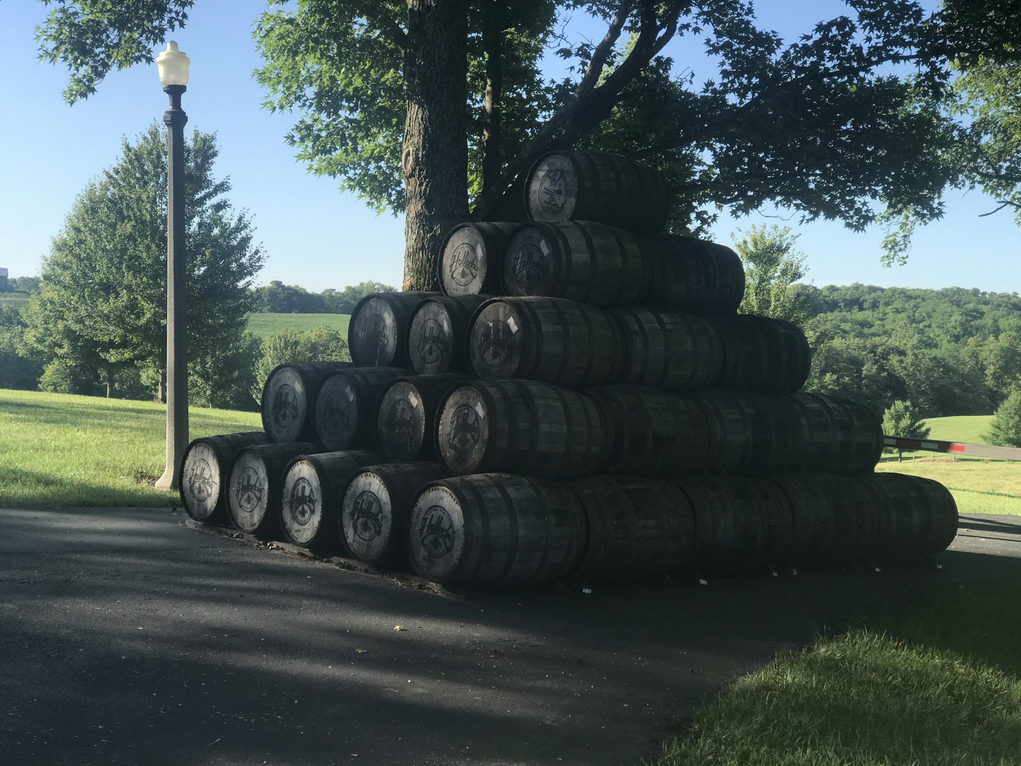
Halladay Winery at Weston MO
Interesting stack of wine barrels
Kansas road sign - The Sunflower State

Platte River of Missouri

I’ve been in the state of Missouri since June 18. I usually visit my relatives in  St. Louis during the summer and typically after a few days I am happy to escape the heat and beat a hasty retreat back to Wisconsin. So after several weeks here, I am frankly looking forward to traveling to a different state.  Missouri is the southernmost state on the trip so moving on signifies beginning the process to travel to cooler regions. 

After crossing the Platte River of Missouri, (I should see the much larger Platte River of Nebraska in a few days.) I travel through my last community in Missouri which is Weston. Weston is a very scenic little community with many historical buildings along with the Halladay Winery. I’ve noticed in my travels that wineries usually mean steep hills! After stopping at a grocery store to stock up on liquids I left the hills of Weston behind and enjoyed some  flat riding for the last several Missouri miles before crossing the bridge to arrive at Atchison, KS. Railroad buffs will recognize the Atchison, Topeka, & Santa Fe. 

After lunch at Atchison, my route took me on Kansas 7, which is also known as the Glacial Hills Byway. Seems surprising that glaciers once covered Kansas. As they receded in this area they left behind a soil layer called loess, so this area is also known as the Loess Hills. 

By late afternoon I arrived at Troy, with no desire to bike any further. Troy is a small community of 1000 people but nevertheless is the county seat of Doniphan County. There are no larger towns around here, and I quickly determined there were no hotels or campgrounds. However, I was in luck, as I had a conversation with a guy who called himself Chuck. He told me I could put up my tent on the fairgrounds, and if anyone questioned me, I should just tell them Chuch said it was ok. So that was my free campsite for the night.  

Miles: 52
Elevations: High 1140 at Troy town square, Low 770 in Missouri.  Kansas Low Estimate 780
Max speed: 29.9


Sunday, July 12, 2020

July 11: Where is the rain?


T
This is Oscar

Starting to sound like a broken record. Sunshine and 92. Yesterday, I heard two guys talking about the weather in Liberty. Talking about the unbroken string of hot days. One said that rain is in the forecast for tomorrow. The other said, “I’ll believe it when I see it.”

I was hoping for a longer ride today, as rain was in the forecast. A brief shower in the morning which I figured I could ride through. Then a more severe storm in the afternoon. Well, the rain shower didnt happen in the morning, not a cloud in the sky. Cloudless skies continued into the early afternoon, and I knew then and there I was going to get no break in the temps today either.  Seems like the Missouri weathermen are about as good as those we have in Wisconsin.

I  arrived at Platte City around 12:30 without taking a look at the temperature on the phone, because I knew what it was going to show.  It was 90. At Smithville I had the opportunity to rejoin the Adventure Cycling map route which I had disbanded several days ago at Higginsville, in order to visit KC. The mapped route was 16 miles, to Platte City, taking a winding route on back roads with numerous turns. Th3 MO state map showed a direct route of 12 miles. I decided to take the direct route, even though I knew what I was in for. The Adventure Cycling map had avoided the obvious Route for a reason; Highway 92 must be bad for cycling. Indeed it was. A busy two lane country highway with no shoulder. Most of it double yellow line as it was up and down.  It was a punishing route, and I knew it was above my temperature limit, but I had no choice. There was no town until a Platte City. Finally I arrived and had lunch at. Dairy Queen. I hung out there for a couple hours  waiting to see if the storms were going to happen. It was either get a hotel room there, or ride 25 miles to the next place.  I gave it up for the day. I made the right choice; 
Another 25 miles in that heat would’ve been dangerous. 

In today’s picture you can see Oscar. I picked him up along the roadway, next to a dead animal carcass. We’ll see how long he hangs around.

Miles: 29
Elevations: High 1011 at Liberty; Low 815 also at Liberty
Max speed: 32.9mph

July 10: From Independence to Liberty


Another mural: Liberty, MO


I took leave of Indpendence this morning with a goal of Smithville, but I had to cut the ride short 15 miles early at Liberty.  The most important measure on the ride lately, has not been how many miles have been traveled, or the number of feet in elevation. It is the temperature. There has been a stagnant air mass in the a Kansas City area, and each day the temperature progression has been very similar, with the temperature hitting 90 by around noon to  one o’clock, and remaining at that level to 7:00PM. Since my self imposed limit is 85 , this means short riding days, and early hotel check ins.

Consequently fewer pictures too, as I concentrate on getting the miles in before the temps become unbearable.  Today’s photos are from another mural, I think a more modern one, taken from the wall of the Clay County sheriff’s office in Liberty. 

The most exciting part of the day was the Missouri River bridge on 271. This road is a major four lane divided highway, which is the direct route between a Independence and Liberty, and I avoided it for much of the way.  But I had no choice, since I had to take the 271 bridge to cross to the north side of the river. I gulped as I approached the bridge, as I saw there was no sidewalk!  The traffic lanes were narrow also and no bike lane. I had passed through a stop light about a mile back which was breaking up the traffic, but there was no way I could ride fast enough to cross the bridge during a traffic break. I was going to have to rely on the traffic going single file to get around me in the passing lane. It turned out to be no problem, as all the cars and trucks moved over into the passing lane as they went by me.  It seems the MO drivers are used to moving over.  I would say 99% give me broad clearance as they pass me by.

Miles: 23
Elevations: High 1009. Low 750 on the bridge
Max speed. 34.2

Liberty mural

Friday, July 10, 2020

July 9: Goin’ to Kansas City, Kansas City here I come


Site of Black Man Lynching 1880s
Emerald City (Kansas City)
Kaw Park - View Upriver (North)

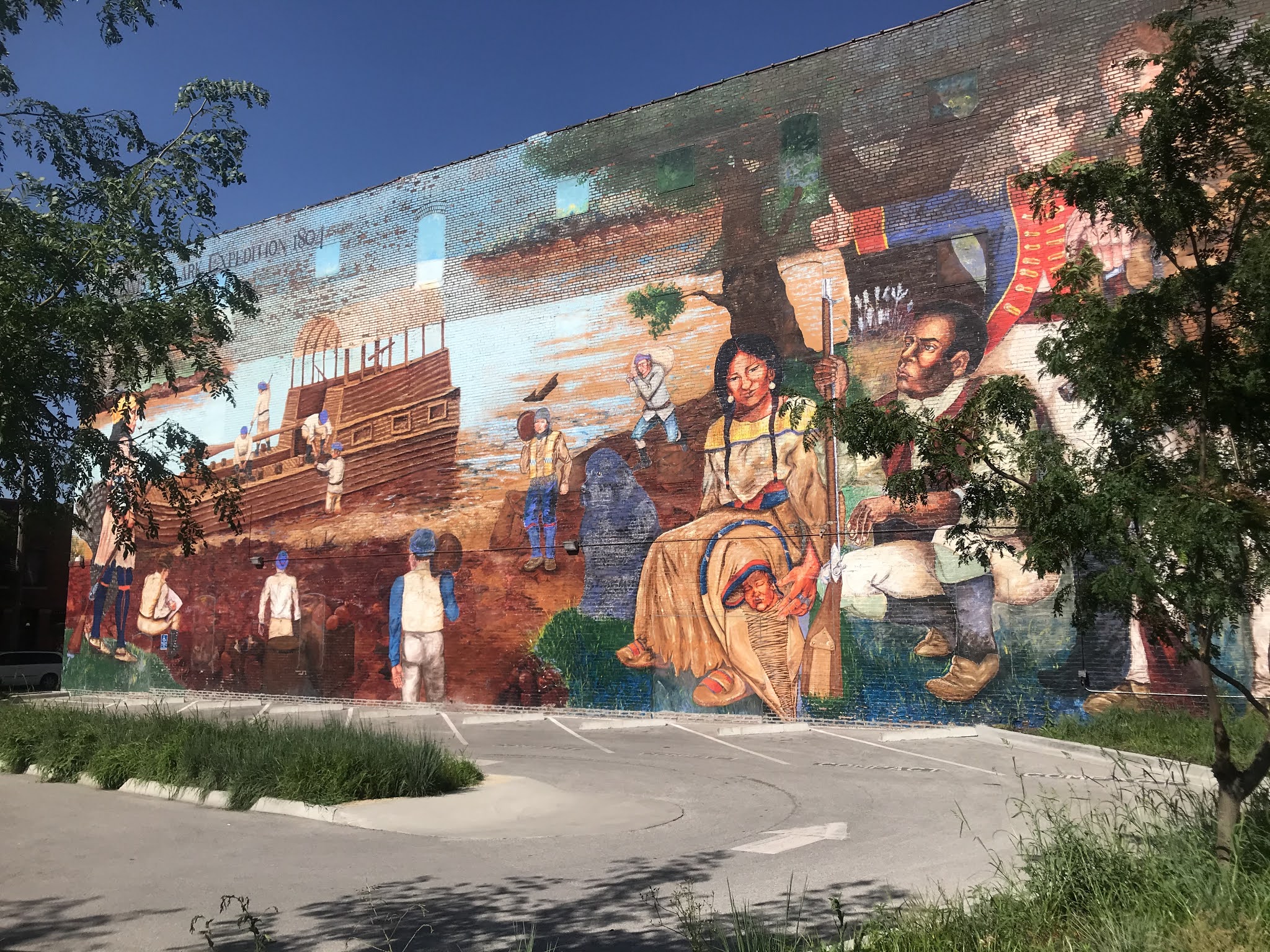
Lewis  & Clark Mural

Today I decided to take a rest day and extended my hotel room for another night, with the plan to check out some sights in a Kansas City. Some rest day! By the end of the day, I had achieved a new high elevation for Missouri and traveled 45 miles, the equivalent of a full day’s ride.

My priority goal was Kaw Park, at the confluence of the Missouri and Kansas Rivers. The trip required traveling through all of Kansas City MO, and crossing the Kansas River into Kansas. I didn’t realize it was 22 miles away.  I was happy to come upon the mural in the downtown area of KC. It is the entire side of a building a block wide.  I was going to pose the question, what is wrong with this mural? But I decided the mural is fine, just as long as the viewer doesn’t assume the mural depicts a scene at KC.  The mural includes Sacajawea and her child. She joined the expedition later. Sacagawea was a very important member of the expetition, and I understand why the artist wanted to include her. 

Kaw Park is actually in Kansas and I had to cross the Kansas River to get there. Once there I got a very interesting view. Staring straight ahead (east) I was looking downriver along  the Missouri River toward St. Louis. On my right, the brownish water of the Kansas River flows in. And to the left (north) Is upriver for the Missouri. It looks blue! I took a video at this point, but I don’t  think I can include the video in this blog.  Too bad, I didn’t take a couple more pictures as a backup. Lewis & Clark must have been excited with this spot, because the Missouri is turning northward  (upriver that is). The water looks clearer, And the size of the river has decreased compared to the start of  the journey.  We are making progress.

On the way to Kaw Park I rode through Independence Square, site of the Truman Library and Museum. Closed for renovation until October, I believe. Many of the businesses  surrounding the square are still closed due to COVID. It really hit this area hard as far as business closures.  And the Square is on top of the highest hill in the area apparently,  Elevation topped out at 1034.  Highest point in Missouri so far. The elevation of the river is 715 at Kaw Park, and since I am going upriver, I should never descend this low on the rest of the trip.

Finally, in regard to the virus situation, enforcement of mask wearing is more severe in Kansas City than anywhere. I’ve been elsewhere.  The Mayor has required masks to enter any business establishment, including gas stations, restaurants, etc.

Miles: 45
Elevations: High 1034 at Independence Square; Low 715 at Kaw Park
Broke through t(e 1000 foot elevation, first t8me since Dubuque, IA
Max speed: 34.4
View from Bluff Top

August 11: Parshall and New Town

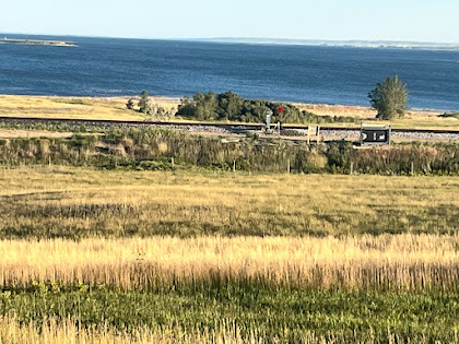
Van Hook Bay of Lake Sakakawea near New Town A familiar foe showed up on day 4 - a tough headwind.  Generally, this year I found the cycling...