 |
| Cheese Country Trail - Mineral Point |
The ATV trails followed the streams. And the streams were probably responsible for the day’s worst affliction. Gnats! Attracted by the perspiration, (and maybe by the sun block too?) They drove me crazy whenever I stopped or slowed down. Mosquito dope does nothing to stop them. It seemed like Platteville was the epicenter of the gnat outbreak, especially by any streams. Finally in the early evening it seemed like I’d successfully ridden out of the worst of the swarms. Checking the internet for information that evening I found a recommended product called Bug Soother, sold at Ace Hardware stores.
Finally, as the sun was setting, I enjoyed the anticipated downhill to the Mississippi River and arrived in East Dubuque, IL. This is where the US 20 bridge crosses the river and it has a sidewalk for bicycles. Except that the bicycle sidewalk was closed for repair! Thank you Google Maps for sending me here. The only way to cross the river is on the US 151 bridge which is actually fine for bikes to use because it has a wide biking lane. But this meant climbing back up the hill I just had come down!
I decided to stop at the closest hotel,which turned out to be super cheap but met my needs for the night. Connected to the hotel was a bar owned by the same guy. It was a Packer bar, and I had the bar pizza for supper, which turned out to be Tombstone Pizza. So I finished the day with a brewski and pizza, and had a nice conversation with the owner. Super helpful guy.
A lot of stuff was thrown at me today, but I persevered for 61.4 miles and still was smiling at the end of it.😊 And I will probably avoid Platteville next time. And Google maps only as a last resort.
Miles: 61
Elevations: High: 1250 = Dodgeville. Low: 645 = E. Dubuque
Max Speed: 40.1
 |
| Shake Rag St - Mineral Point |
 |
| Bridge on Pecatonica ATV Trail |
 |
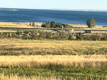
| Wisconsin countryside near Dubuque |
 |
| Wisconsin country |
 |
| Illinois state line |
 |
| My hotel at E. Dubuque |

No comments:
Post a Comment