Friday, July 10, 2020

Thursday, July 9, 2020
July 8: Good ride to Independence
 |
| Nice Farm near Independence MO |
As I got closer to Independence which is a suburb of Kansas City, the road turned into Truman Road, which turns into the Main Street of Independence where the Presidential Truman Library and home, and other historical sites are located.
I have now completed my trek following the track of the Missouri River across the state. I am now in the Kansas City area, at which the river takes a more northerly course (Yay!) and becomes the border between Kansas and Missouri. I’m not sure if I will be traveling in either Kansas or Missouri for the next part of the trip. Probably looking at maps each day to see which state offers the better looking route.
Hotel tonight is a very nice place. Stoney Creek Resort and Conference Center. There is another one in Wausau WI. Three of the last four hotels have been on I-70 (Boonville, Higginsville, and today). My bike routes have not been along I-70, but that is where I always seem to end up at the end of the day. In reality, that is where the hotels are.
Today my elevation high was 953, so I’m getting back close to the thousand foot mark. I’ve noticed that the daily high elevations have been slowly increasing, which of course I expect as I make my way west. The 953 elevation is the highest elevation I have had in all of Missouri. The highest point in all of Missouri is Taum Sauk at 1775 feet.
Miles:47
Elevations: High 953, near Independence: Low 696
Max speed: 34.4
 |
| Highway FF becomes Truman Road |
 |
| Farm area along Truman Road |
Tuesday, July 7, 2020
July 6: Day camping in Corder, MO
 |
| Santa Fe High School in Alma |
 |
| My resting spot at Corder VFW |
 |
| View from Corder park. Nice community |
 |
| My park bench at the Corder City Park. |
 |
| My park bench in Corder Have you ever had to wait for something for 10 hours? Today, I did. The goal today was Higginsville, 40 miles, still in Missouri. A stretch goal was 16 miles further at Lexington; it became apparent that Higginsville was all I would be capable. Up with the sun I got an early start, and I moved along quickly for the first 25 miles. Feeling good. I was well stocked with water and Gatorade, having learned that lesson earlier. The temps climbed quickly today, with typical high humidity. By 10:00AM the temperature had already climbed to 88, which is above my comfort zone. No wind to speak of, and no shade. At this point I am about 7 miles from Higginsville. Those last miles were interesting to say the least. I am trying to make safety paramount in this trip. That means listening to my body when conditions become extreme, and today qualified as extreme. I found myself looking for any shade I could find to cool down. Finally I came upon the Corder community VFW Hall. Nobody around but there was a patio area for smokers, which offered shade from an overhang. The time was around 10:30. I rested for a couple hours as the temp climbed to 90. I tried to get up on the bike, and immediately became lightheaded. (I am taking a new medication, which lists lightheadedness as a possible side effect. I think that medication along with the heat were the primary causal factors.) At this point I knew I would simply have to wait for temps to come down before I could resume the ride. From this experience, I have now set a temperature limit of 85 for his ride. One of the members of the VFW came by and he opened the building for me, and I got a chance to run cold water on myself, which helped a lot. I was about a half mile from the community of Corder, and I had checked by phone on the possibility of getting indoors there. Possibilities: a library, but it was COVID closed. A cafe, but closed on Mondays. Other than that a bank, but who is going to wait for temps to fall at a bank, which was going to close before the temps came down. No gas station. The VFW guy suggested the city park which has restrooms with running water. So that was where I went. At this point I was feeling ok, but I had decided to abide by my temp limit of 85. During this experience I consumed approximately a gallon of fluids, which I was carrying on the bike. Finally at 8:30PM the temp dropped to 84. The hotel turned out to be 5 miles from Higginsville, so I rode the last 12 miles without problems. Listening to my body, I am taking another rest day today at the hotel, using the day to catch up and recharge all of my devices, etc. I have also made a decision about my route. I am using maps of the route which are published by Adventure Cycling Association. The maps are excellent. However, I have some disappointment on the route these maps are taking. I have not seen the Missouri River during the last two days, As the maps are taking me on hopefully more quiet country roads, not necessarily close to the river, which is where I want to be. Also another problem is lack of services along the mapped route. There were three towns on today’s journey between the ending points of Marshall and Higginsville. These were Blackburn, Alma, and Corder, all less than 500 people. No services, or places that were closed. The only restaurant in Alma and in Corder were closed. This seems less safe to me. Tomorrow, with a good ride I should get to Independence which is a suburb of Kansas City. The AdventureCycling Maps avoid the entire Kansas City area completely, even though geography buffs realize that Kansas City lies on the Missouri River. I am looking forward to seeing some places in Kansas City, so I will probably take another rest day there too. Miles: 41 Elevations, High 864 at Corder Low 695 near Higginsville, Reservoir Max. Speed: 26.2 |
July 5: Lemonade Aqui! Marshall and Math Q1
 |
| Lunch at the Catalpa Restaurant - Arrow Rock |
- Surface - the Katy Trail has a crushed limestone surface. So like a well-maintained dirt road. It becomes very sloppy when it rains, and it is slower to ride on. I am looking forward to traveling on pavement.
- Cars - an obvious advantage for riding on the trail; no motorized vehicles allowed. However still need to contend with road crossings.
- Slope - this is a big one. The Katy Trail is a converted railroad track bed. Elevation changes are very gradual. Now on roads, I have to contend with normal uphills and downhills, a two-edged sword. Downhills are wonderful, and with all the gear and me on the bike, i5 feels like I descend faster than normal. Maybe not, but it seems that way. But the uphills are slow, really slow. That’s the reason railroad track beds are set with very slow elevation changes. Lifting that weight up the hill, especially steep hills is a lot of work! I find I am forced to use my granny gears a lot. Normally I don’t need them.
- Bicycle facilities - the Katy Trail is a hall-of-fame trail with many campgrounds, restaurants, BNBs nearby. On the regular roads these will be harder to find.
- SHADE! - most of the trail offers shade from trees lining the trail. A huge advantage at this time of year.
So, about today’s ride. Halfway through the route today,I stopped at Arrow Rock Historic Site, which is both a landmark and a community. Arrow Rock was a landmark sighted by the Lewis & Clark expedition. A community grew on the site, and Arrow Rock is also the name of the community.
The Main Street of Arrow Rock has been maintained with its mid 1800’s construction. If you’ve been to Greenfield Village at the Henry Ford Musuem at Detroit, it’s the same idea. I think COVID has been disastrous for this site. When I arrived there was nobody else in the visitor center, nor did anyone show up while I was there. This was at11:00AM (Sunday). Remember the Maytag repairman? I think the lady who managed this visitor center has a similar job; nobody around, nothing to do.
Most of the stores on Main Street were closed. The only place open was an ice cream shop, but I wanted a more substantial lunch. There was a single restaurant with outdoor seating, on a nearby street, called the Catalpa. It was the only place open, and I think most of the customers were locals. They converted an old church building into a theater, with a schedule of plays throughout the year. Everything cancelled until at least December.
I decided to not visit the actual Arrow Rock landmark. It would’ve meant a 100 foot hill down and then back up. The sun was already getting hot. I did not see the Missouri River at all today. The only opportunity was at Arrow Rock, and it was obscured by trees, etc.
After lunch, I head out on the second half of today’s ride. Something like 16 miles to Marshall. As the temperature heats up, the miles go by more slowly, and I arrive in Marshall with a raging thirst, for anything ice cold. I get tired of drinking 90 degree water from the water bottles. You can tell this town is not in Wisconsin! The town has a central square and main highways coming into town from all four directions. Sign says 13,000 people. Think of Monroe, or Waupaca, for example. I’m coming in from the north side, looking for any gas station, restaurant, bar, to slam down something icy. I came in from the wrong side of town in this regard, because nothing open on this main highway. I get to the central square; nothing open all 4 sides, nothing on any of the side streets either. Now it is Sunday, but really? Not even a bar?
I continue toward the south side of town, and then make the right turn on the main road leading to the western side where my hotel is. Finally, as I approach the western edge I can see McDonalds, Walmart, Sonic signs, etc. Just when I am in view of this commerce section, I hear a kid, “Lemonade, aqui!!”. He practically runs out into the street; he with his Mom is running a lemonade stand. One of life’s lessons I’ve learned is always stop and buy from a kid selling lemonade. To see the kids smile is priceless. I was probably the first customer, because the two lemonade pitchers looked full. Maybe helping a budding entrepreneur.
Miles: 41
Elevations: High 802 in Marshall (the daily rides always seem to end with an uphill; Low 602
Max speed: 26.7 mph
PS: I am calling myself the Math.Guy. Math problems pose themselves along the way which are fun to try to solve mentally. A way to pass the time. Of course you can skip these, But if you like math, maybe you’d like to give some of these a try. I will follow up with my answer, not necessarily the right answer, in a couple days!
Math Puzzle 1: in this post above I talk about uphills and downhills, compared to level riding. Imagine Mark averages 8 mph on his bike, fully loaded, on level ground. So now his route takes him up a one mile hill, and he slows down to 4 mph, to climb the hill. Then a one mile downhill follows. How fast does Mark have to travel on the downhill to average 8 mph overall?
 |
| American Elm |
 |
| Chicory, also called blue weed |
 |
| Arrow Rock Monument |
 |
| Theater at Arrow Rock COVID closed |
 |
| Main Street at Arrow Rock |
 |
| Arrow Rock |
 |
| Catalpa Trees provide the shade |
Sunday, July 5, 2020
July 4: Back on the road - I Ride to Boonville
 |
| Final day on the Katy Trail |
The photo above is one of my favorites of the river from the Katy. Here the trees and brush have been cleared away, so we have a clear view of he Big Muddy. Perhaps my imagination, but maybe the Missouri is looking a bit less muddy here?
My favorite part of the day was probably at Coopers Landing. It’s a campground right on the river, and it doesn’t show up on my bike map, so a surprise for me. Since it’s the 4th, I added a bit of variety to my beverage purchases at the campground store.
One key aspect of the Katy Trail I sure am going to miss is the bountiful shade. For awhile today I had to detour from the Katy Trail due to a bridge damaged by flooding. The detour took me onto regular roads - felt much warmer without the shade.
At the end of the day’S ride, I came across the northern terminus of the Santa Fe trail, near Franklin. This area was an important one as the West opened up in the early to mid 1800’s. The Santa Fe trail provided trade with Mexico, and of course New Mexico. Kit Carson was born near here. Several overland routes converged in this area. Reading about the trails and the characters reminded me of my youth, when I would go to the Medford Public Library and check out books about Kit Carson, Buffalo Bill, and a host of other Mountain Men. Do kids today know about these guys?
 |
| Ending the Katy; beginning the Santa Fe Trail |
 |
| Lewis & Clark camped here June 9, 1804 |
 |
| Keeping hydrated - Coopers Landing |
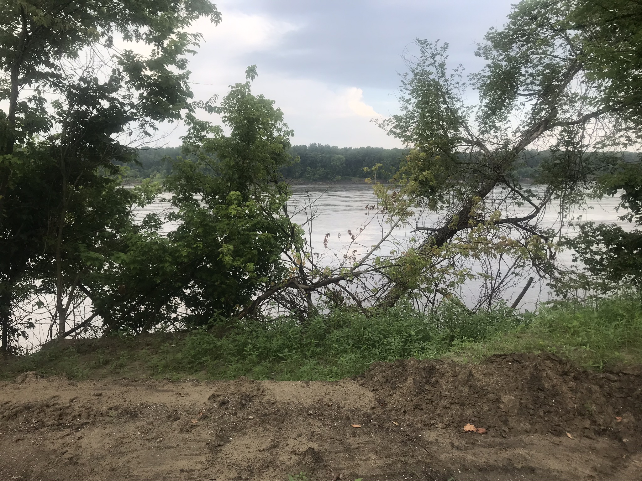 |
| Typical view from Katy Trail |
 |
| Katy Trail is very shady here |
 |
| Corn is supposed to be knee-high today |
July 2: Jefferson City
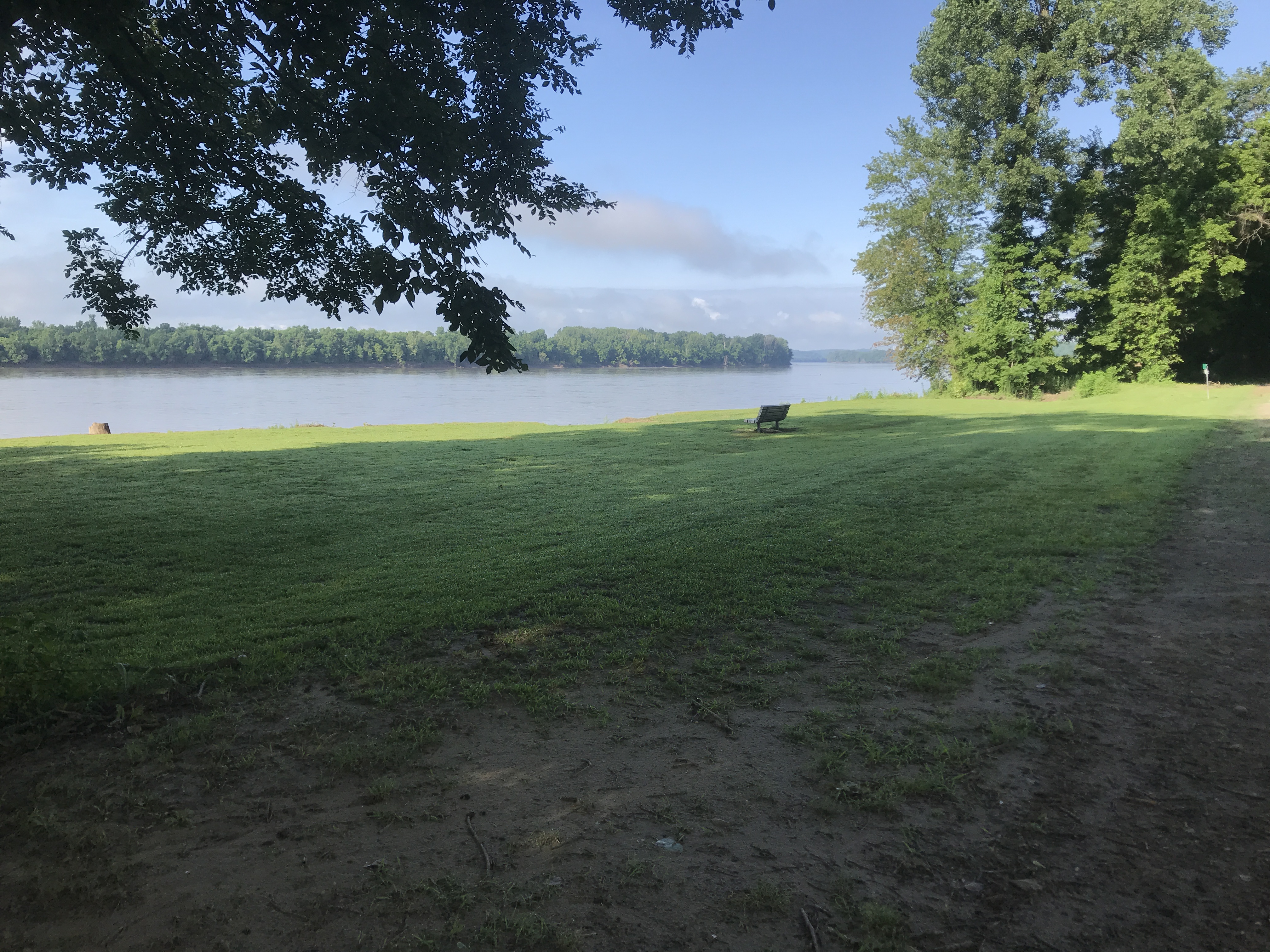 |
| Missouri River View from Katy Trail |
It seems that I see more critters from the trail than I would typically see on a ride in Wisconsin. An inventory so far: 🐢 including the beautiful colors which didn’t show up in the picture below, rabbits of course, a family of raccoons, a big white rat, a family of birds still in the nest, a garter snake, only one deer on the trail so far, lizards, and a small animal which might have been a weasel or a mink. Trying to avoid a flat tire, I try to avoid sticks on the trail, and ride around them. Sometimes the sticks look like snakes until I get close enough. So it is surprising that I ran over the garter snake before realizing what it was!
Finally, I see the Missouri Capitol building from a picnic bench by the trail, which was sponsored by a former governor. In order to get across the river cyclists need to get up to the level of he US Highway 54 bridge. This is accomplished by climbing a three level bike ramp that connects to the bridge sidewalk. This ramp was donated by Mrs. Ted Jones. Ted Jones and his wife donated $2.2 million to begin the transition of the trail from a railroad right away to the Katy Trail which is a 240 mile long but very thin state park. The Katy Trail was the longest rail trail in the country. Who are the Jones’s? They were the founders of Edward Jones - the financial consultants. So they could probably afford it.
Finally the last photo is from the Capitol grounds. It is a famous sculpture which depicts the signing of the Louisiana Purchase from France by Thomas Jefferson in 1804. Also a shrewd businessman, the purchase doubled the size of the USA. Later that year, Lewis & Clark left on this little trip to see what he bought.
Miles: 37
Elevations: High: 621 on the Jeff City bridge; Low 523 on the trail
Max speed 25.7
 |
| Typical river view from trail |
 |
| Turtle Crossing |
 |
| Capitol building from trail |
 |
| Cottonwood tree |
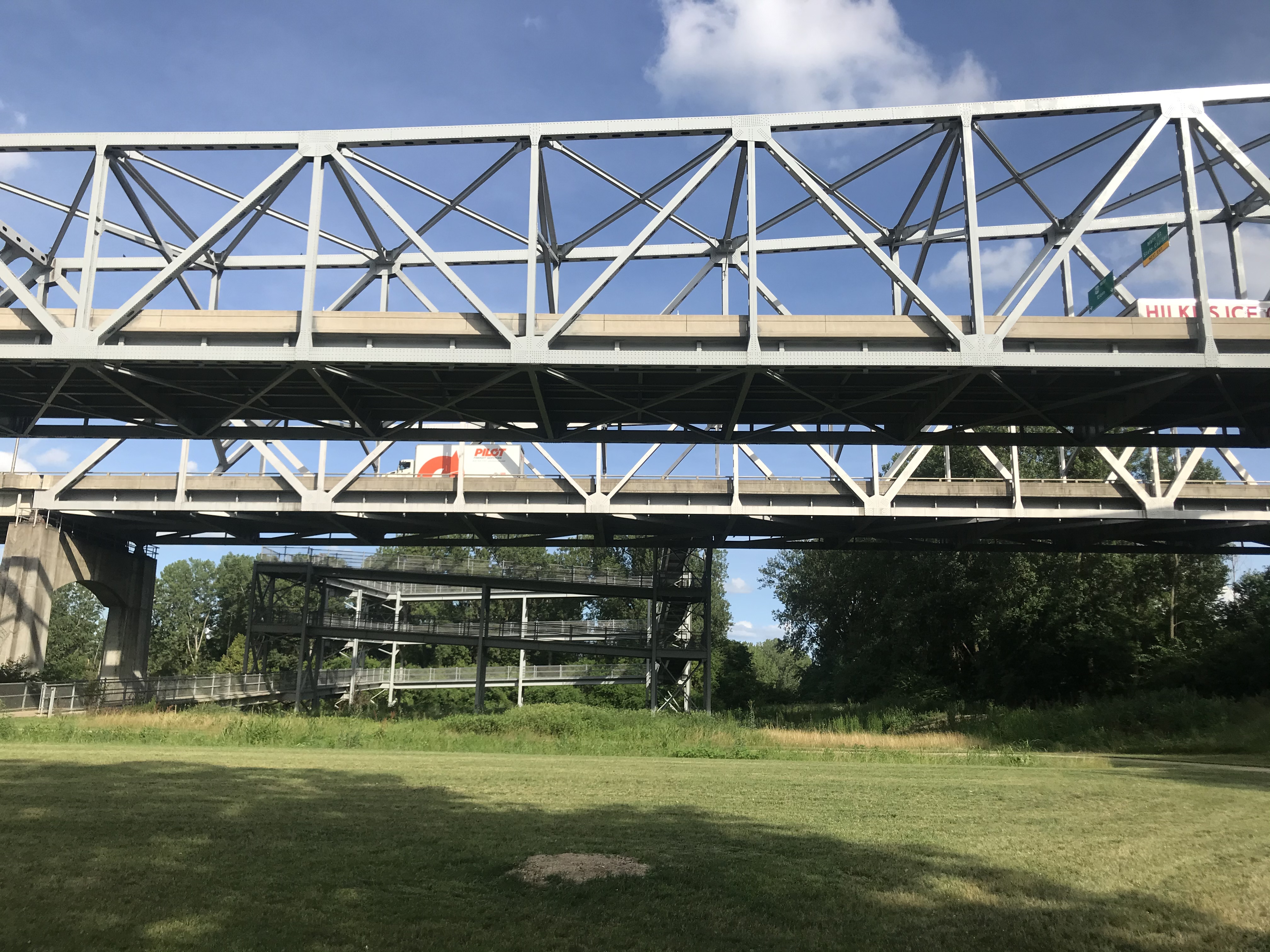 |
| Elaborate triple level bike ramp to highway bridge |
 |
| Capitol building from Missouri River Bridge |
 |
| Fountain commemorates Jefferson signing Louisiana purchase |
Friday, July 3, 2020
July 1: Daniel Boone Country
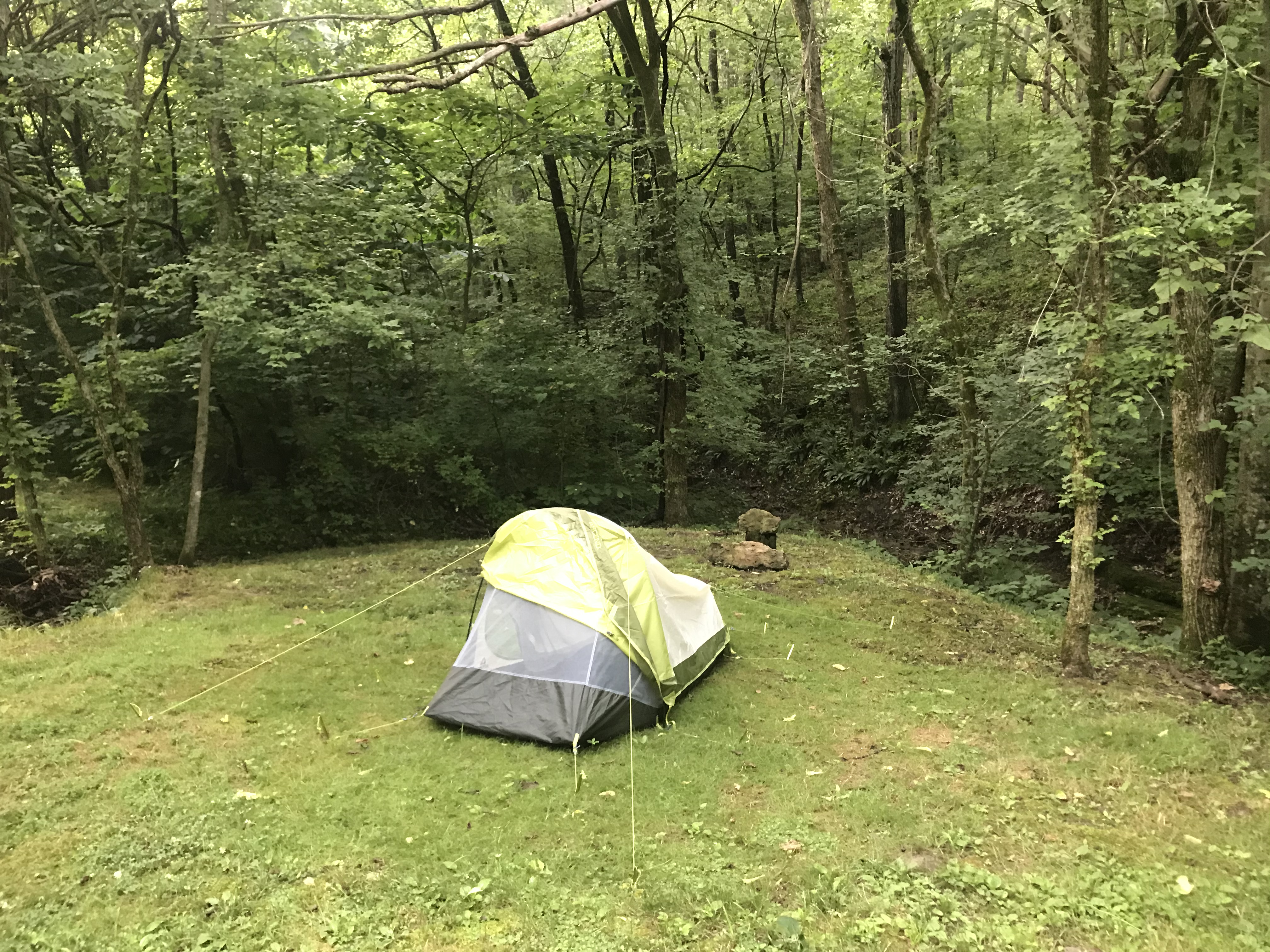 |
| ‘Rustic’ website at Bluffton |
Leaving Washington, it was another 5 miles to get back to the Katy Trail. Probably the sightseeing highlight today was a quick stop at the Daniel Boone monument. They have a farmstead constructed as it would have been in the the early1800’s with some Indian tepees on the back forty. I guess they cater to weddings; nobody around today. The monument is the burial site of Daniel Boone. When he moved to Missouri, near the end of his life, this prompted many more settlers to follow. Its interesting that there is no record of Lewis & Clark meeting Boone, although he should have been here when the expedition passed by.
Something that is interesting for me is comparing the calendar dates for me with the calendar dates in 1804 when Lewis & Clark traveled the same route. For example it was May 23, 1804 when L&C left St. Charles, and on May 29 they arrived where I am now. By comparison, I left St. Charles on June 30, so the expedition has about a 38 day head start on me. So the question is, will I catch the expedition? What date will that be, and where will that be? I will keep you posted, in case anyone would like to make some predictions?
The photo above was my campsite at Bluffton. I’m pushing the envelope on type of weather thatI should consider camping. Tonight the temp was 84 at 8:00PM when I arrived, with high humidity. The campground was a bit dilapidated, and I was the only camper there. I chased a deer - OK, startled a deer at my campsite. I chose to use the rain fly tonight because there was a 20% chance of rain. I prefer to not use the rain flyin the hot weather. Also the rain fly doubles the effort needed for set up and tear down.
PS: Camping was ok, but a little warm. Worst aspect was the next morning when everything, is moist from the humidity an dewfall. Rode with damp clothes entire next day.
Miles: 45
Elevations: Low 467, near Treloar; High 599 at Marthasville
Max Speed. 34.5mph
 |
| Tepees at Daniel Boone Farm |
 |
| Daniel Boone Farm |
 |
| Daniel Boone Burial Site |
 |
| Taken from a bridge on the Katy Trail |
Subscribe to:
Posts (Atom)
August 11: Parshall and New Town
Van Hook Bay of Lake Sakakawea near New Town A familiar foe showed up on day 4 - a tough headwind. Generally, this year I found the cycling...
-
 Survey marker 40 Degrees latitude Kansas cornfield Weaver hotel - the phone works My free campsite on the fairgrounds at Troy View of four s...